Planning a visit to Mt St Helen
Driving Times
Important phone numbers:
Mount St. Helens National Volcanic Monument
Monument Headquarters (360) 449-7800
Mount St. HelensVisitor Center3029 Spirit Lake HighwayCastle Rock, WA 98611
(360) 274-0962(Operated by Washington State Parks and Recreation Commission)
Mount St. Helens Visitor Center at Silver Lake
Elevation 505 Feet / 154 Meters
Summer Hours: Daily 9 a.m. to 6 p.m.
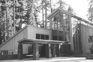
Located 5 miles east of Castle Rock on the shores of Silver Lake, the Center introduces visitors to Mount St. Helens' history and to the powerful events that took place on May 18, 1980. Take a walk on the 1 mile Silver Lake Wetlands Trail and discover how this lake was formed by a previous eruption and how the aquatic life continues to change Silver Lake today! Visitors can enjoy distant views of Mount St. Helens, and Silver Lake while identifying native plants, birds, and other wildlife.
Services include a 16 minute theater presentation, interpretive exhibits, a staffed information desk, and Northwest Interpretive Association book sales area. You may continue your hiking adventure into Seaquest State Park, located directly across Highway 504 from the Visitor Center. Seaquest offers camping, hiking and picnicking.
Services include a 16 minute theater presentation, interpretive exhibits, a staffed information desk, and Northwest Interpretive Association book sales area. You may continue your hiking adventure into Seaquest State Park, located directly across Highway 504 from the Visitor Center. Seaquest offers camping, hiking and picnicking.
Coldwater Ridge Visitor Center
Elevation 3,091 Feet / 942 Meters
Summer Hours: Daily 10 a.m. to 6 p.m. (starting May 5, 2006)
Situated within the National Volcanic Monument and 43 miles east of Castle Rock, the center will be subjected to winter conditions. Opportunities outside the building will be subject to snow depths and conditions.
Services inside the center include a video-wall theater program, interpretive exhibits, a staffed information desk, a gift shop, a Northwest Interpretive Association book sales area. The restaurant portion will provide a limited menu during the winter months, call the center for specific items available.
Highway 504 will be maintained and plowed by Washington State Department of Transportation. Please drive cautiously while plows are present and plowing.
Johnston Ridge Observatory
Elevation 4,255 Feet / 1,297 MetersDaily 10 a.m. to 6 p.m. (May 5th-October 31st, 2006)
Located at the end of State Highway 504 and 52 miles east of Castle Rock, in the heart of the blast zone, the Center's state-of-the-art interpretive displays magically portray the sequence of geologic events that transformed the landscape and opened up a new era in the the science of monitoring an active volcano and forecasting eruptions. Read amazing eyewitness accounts from eruption survivors.Take a .5 mile walk on the Eruption Trail and learn how the eruption shaped the surrounding landscape. Visitors can expect to see views of the lava dome, crater, pumice plain, and the landslide deposit.Services include a wide-screen theater presentation, interpretive exhibits, a staffed information desk and a Northwest Interpretive Association books sales area. No food service available at this site.


1 Comments:
Great posting! Keep up the good work.
Post a Comment
<< Home